River
Rhine vs Danube river cruises
Europe's two busiest cruise rivers run in different directions, through different kinds of country, carry different numbers of locks, and are exposed to water levels in different ways. The better choice depends on what a traveller actually wants from the week, not on which river is 'better'.
The short answer
Neither river is objectively better: they answer different questions. The Rhine runs south to north from the Alps to the North Sea, and its cruises usually link Switzerland, France, Germany and the Netherlands between Basel and Amsterdam in a compact, industrious corridor with one short, intense scenic gorge. The Danube runs west to east from Germany to the Black Sea, and most cruises link Germany, Austria, Slovakia and Hungary between Passau and Budapest, passing several national capitals and broader, more varied landscapes over a longer stretch of river.
A traveller who wants castles and vineyards concentrated into a short, easy trip tends to prefer the Rhine. A traveller who wants capital cities, a longer sense of journey, or the option to keep going east towards the Balkans tends to prefer the Danube. Both rivers can run too low in dry summers and too high after heavy rain, at different points along their length, and both have genuinely disrupted cruises in recent years.
By The SnapVoyages TeamPublished October 2026
At a glance
Two rivers, two axes
- Rhine — flows
- South → north, Alps to North Sea
- Core cruise stretch
- Basel – Amsterdam, about 700 river km
- UNESCO highlight
- Upper Middle Rhine Valley
- Danube — flows
- West → east, Black Forest to Black Sea
- Core cruise stretch
- Passau – Vienna – Budapest, about 950 river km
- UNESCO highlight
- Wachau Cultural Landscape
The two systems are physically joined by the Main and the Main–Danube Canal, so some voyages sail the whole way from Amsterdam to Budapest, crossing the continental watershed between the North Sea and the Black Sea on an artificial waterway. Full river profiles, including every section and stop used on this page, are on the Rhine and Danube pages.
Geography
Where each route actually runs
Plotted from the coordinates of cities actually used as river-cruise stops in this project's own river data, connected in geographic order along each river. This shows relative position and direction of travel only — it is not a navigation chart, does not show the river's true course between cities, and no single itinerary calls at every point shown.
Side by side
Route characteristics
| Rhine | Danube | |
|---|---|---|
| Countries on typical cruises | Switzerland, France, Germany, Netherlands | Germany, Austria, Slovakia, Hungary; longer voyages add Serbia, Romania, Bulgaria |
| Representative cities | Basel, Strasbourg, Mainz, Koblenz, Cologne, Amsterdam | Passau, Melk, Vienna, Bratislava, Budapest |
| Signature scenery | Upper Middle Rhine gorge: vineyard slopes, hilltop castles, small towns squeezed against the rock | Wachau valley between Melk and Krems: wider vineyard terraces, abbeys, villages |
| Character | A busy working waterway with compact distances between stops | Broader agricultural landscapes between several national capitals |
| National capitals called at | None of the core stops (Amsterdam is the capital at the route's end) | Vienna, Bratislava and Budapest on one typical voyage |
| Low-water sensitive point | Middle Rhine, tracked at the Kaub gauge | Bavarian stretch between Straubing and Vilshofen; Hungary and the lower river in severe drought |
Landscape and culture
What each looks like from the deck
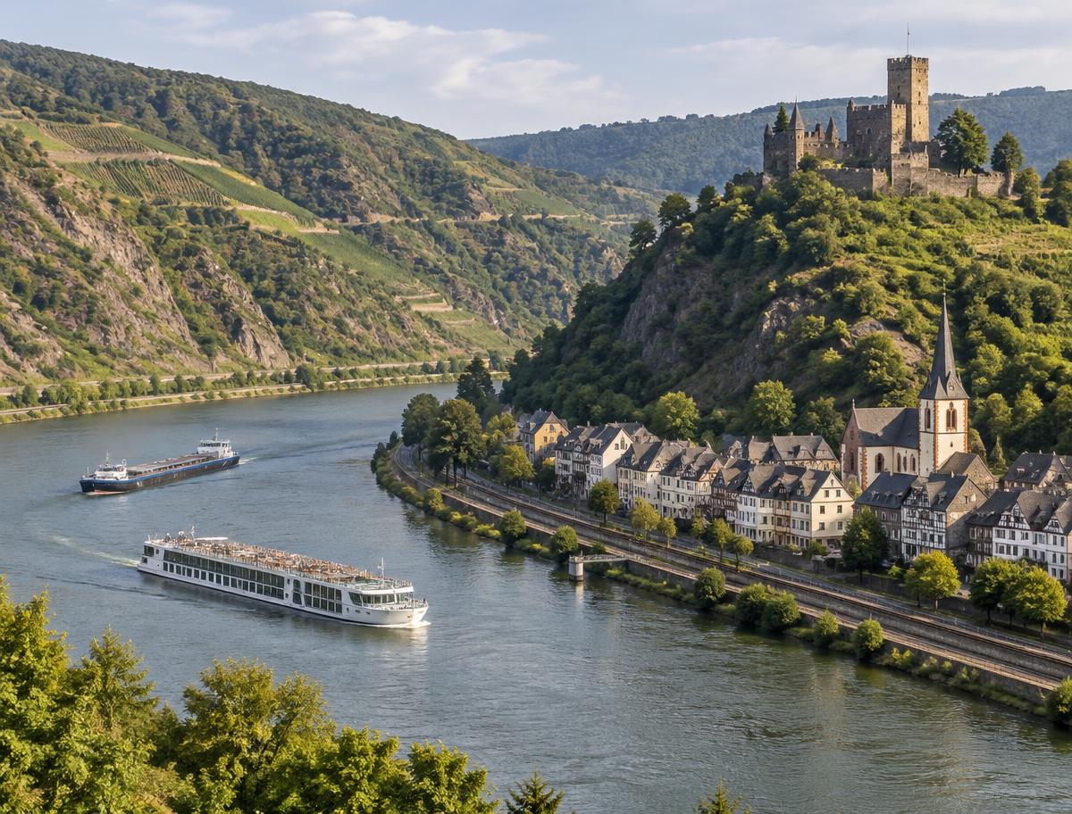
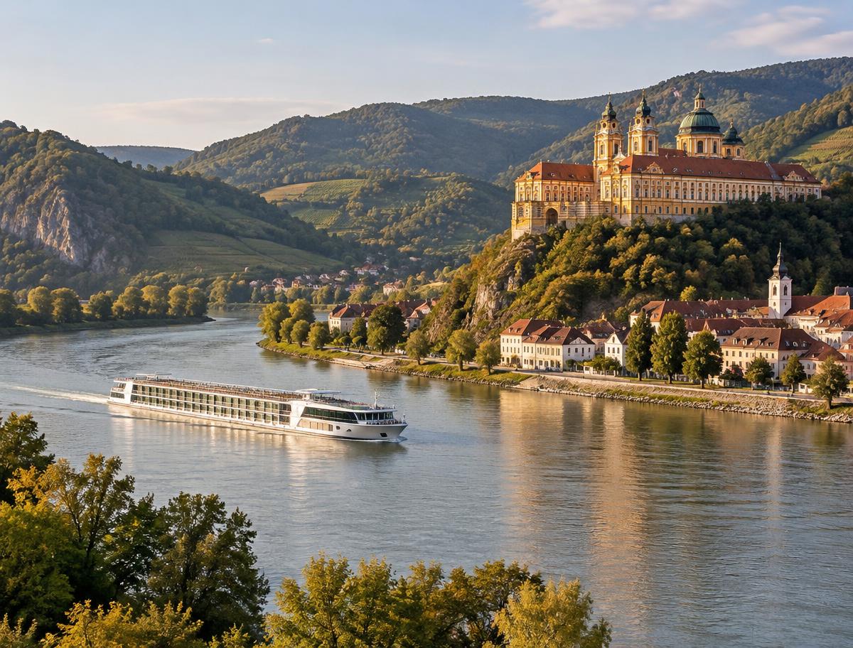
The Rhine
- Medieval towns, vineyard slopes and castles in close succession along one short stretch.
- A sharp contrast between the scenic Middle Rhine and the heavily industrial Lower Rhine and Ruhr approach.
- Cruises often finish among Dutch canals, windmills and cities in the delta.
The Danube
- Three national capitals — Vienna, Bratislava and Budapest — within a single common itinerary.
- The Wachau's abbeys and wine villages are the one widely recognised scenic highlight; much of the rest of the upper and middle river is quieter countryside.
- Voyages that continue east reach the Balkans, the Iron Gates gorge and the Danube Delta, a landscape with little in common with the river's Austrian stretch.
UNESCO describes the Wachau as "a stretch of the Danube Valley between Melk and Krems, a landscape of high visual quality" that preserves monasteries, castles, towns and vineyards from a long continuous history of settlement. The description applies specifically to that one 36-kilometre stretch, not to the Danube as a whole — most of the river's cruised length looks quite different.
One river, two feels
How the eastern and western Danube differ
'The Danube' describes roughly 2,850 kilometres of river. The stretch most first-time cruisers see is a small, specific part of it.
| Upper/middle Danube (Passau–Budapest) | Lower Danube (Iron Gates–Black Sea) | |
|---|---|---|
| Typical use | The default, most-booked Danube itinerary | An extension offered on longer voyages, far less commonly sailed |
| Navigation | Heavily locked through Germany and Austria; largely free-flowing and wide from Vienna to Budapest | Free-flowing with no locks below the Iron Gates; mooring points are more basic |
| Townscape | Cities and towns sit directly on the water; most stops are a walk from the historic centre | Towns are fewer and often set back from the river; a stop is more likely to mean a coach transfer inland |
| Scenic character | The Wachau valley is the recognised highlight; otherwise mixed agricultural and urban landscape | Broad, sparsely built river country, ending in the UNESCO-listed Danube Delta wetland |
A Rhine-versus-Danube comparison that treats "the Danube" as one homogeneous experience misses this split. Someone who has sailed Passau to Budapest has seen a different river, in most practical respects, from someone who has continued on to Bulgaria, Romania or the delta.
Seasons and hydrology
Water levels on each river
Both rivers can run too low in dry summers and too high after heavy rain or snowmelt, which closes passages under low bridges. This is not a hypothetical risk: in the summer 2022 European drought, the New York Times reported that low water forced cruise companies to move passengers by bus along sections of both the Rhine and the Danube, with the stretch between Straubing and Vilshofen on the Bavarian Danube among the worst affected. In July 2026, Reuters reported Danube levels near record lows further downstream, with vessels stranded north of Budapest and, in Romania, the lowest levels since 1996.
When levels fail, operators have a limited set of responses: swap passengers between ships, transfer people by coach between ports, cancel calls, or cancel the sailing outright and rebook guests. None of these outcomes is unique to one river — both have experienced all of them in different years. Low water on the Rhine is tracked in real time at the Kaub gauge, on the Danube by the national waterway authorities. How the seasons and water interact across the whole of European river cruising, including month-by-month patterns, is covered in when to take a European river cruise.
Water level is a property of the year and the season, not a fixed trait of one river
Both rivers have had seasons with serious disruption and seasons with none. Comparing them by long-run reliability would need a published, river-wide statistic that does not exist in a form usable here — this page describes documented events, not a probability.
Experience level
A first river cruise versus a repeat one
The right river can depend as much on how many European river cruises someone has already taken as on the destinations themselves.
First river cruise
Reasons the Rhine is often recommended
- A short, legible corridor: five or six distinct days, each with its own clear identity, in a modest length of river.
- The Middle Rhine gorge delivers an immediately recognisable 'this is what a river cruise looks like' experience early in the trip.
- Good onward flight and rail connections at both ends, in Basel/Zurich and Amsterdam.
Repeat river cruiser
Reasons travellers often choose the Danube, or go further, next
- Three capital cities in one itinerary gives more urban variety to someone who has already done one or two river trips.
- Longer voyages that continue past Budapest towards the Balkans, Bulgaria, Romania or the Danube Delta are genuinely different again and suit someone wanting new ground.
- Someone who has already sailed the core Danube may look at the Rhine's Moselle or Main extensions, or at the Elbe, Douro or Seine, for a change of character rather than repeating the same river.
Reader profiles
Three travellers, three different answers
Hypothetical traveller
A short, scenic break with limited time off work
Wants castles, vineyards and a photogenic river in a compact week, flying into one nearby airport and home from another close by. The Rhine's short, concentrated gorge and the easy Basel/Amsterdam flight geography suit this better than the Danube's longer, more spread-out upper stretch.
Hypothetical traveller
A first-time cruiser drawn to capital cities
Primarily wants grand architecture, museums and imperial history rather than small towns and vineyards. Vienna, Bratislava and Budapest on a single Danube itinerary deliver three distinct capitals; the Rhine's core stops are mostly mid-sized cities and towns rather than capitals.
Hypothetical traveller
An experienced river cruiser wanting something further
Has already sailed the core Rhine and the core Danube and wants new ground rather than a repeat of either. A longer Danube voyage into the Balkans, Romania or the delta, or a change of river entirely to the Elbe, Douro, Seine or Rhône, offers more genuine novelty than re-sailing Basel–Amsterdam or Passau–Budapest.
Where comparisons break down
What a broad Rhine-versus-Danube comparison cannot tell you
Why 'the Rhine' and 'the Danube' are each several different trips
An operator's Rhine itinerary might run the full Basel-to-Amsterdam distance, or might cover only the Middle Rhine over a long weekend, or might turn off into the Moselle for most of the trip. A Danube itinerary might be Passau to Budapest and back, a one-way Budapest-to-the-Black-Sea voyage, or a short loop around Vienna and the Wachau alone. These are materially different holidays that this comparison, by design, treats as one river each.
The river itself also does not stay the same from year to year. A season with an unusually dry summer or an unusually wet autumn can change which stretches run smoothly and which do not, on either river, independent of anything in this comparison.
Sources & verification
River geography and lock infrastructure from waterway administrations, UNESCO and the Rhine and Danube's own hydropower operator; 2022 and 2026 low-water disruption from contemporaneous reporting. Routes are described as typical patterns, not as any one operator's current itinerary.
- UNESCO World Heritage — Upper Middle Rhine Valley — read 2026-09-01
- UNESCO World Heritage — Wachau Cultural Landscape — read 2026-09-01
- UNESCO World Heritage Centre — Wachau Cultural Landscape, brief description — read 2026-10-10
- ELWIS — Kaub gauge water-level forecast — read 2026-09-01
- viadonau — Austrian waterway administration — read 2026-09-01
- Central Commission for the Navigation of the Rhine (CCNR) — read 2026-09-01
- CCNR — Information on the waterway Rhine — read 2026-10-10
- WSA Oberrhein — Iffezheim Lock technical factsheet — read 2026-10-10
- VERBUND — Danube run-of-river power plants and locks, Black Forest to Black Sea — read 2026-10-10
- WSV — Main-Danube Canal — read 2026-10-10
- Danube Commission — read 2026-09-01
- International Commission for the Protection of the Danube River (ICPDR) — read 2026-09-01
- Reuters — Near-record low water levels disrupt tourism on Danube (16 July 2026) — read 2026-10-10
- Reuters — Danube water levels reach lowest in 30 years (20 July 2026) — read 2026-10-10
- The New York Times — Low Water Levels Disrupt European River Cruises (29 Aug 2022) — read 2026-10-10