Buccaneer Archipelago
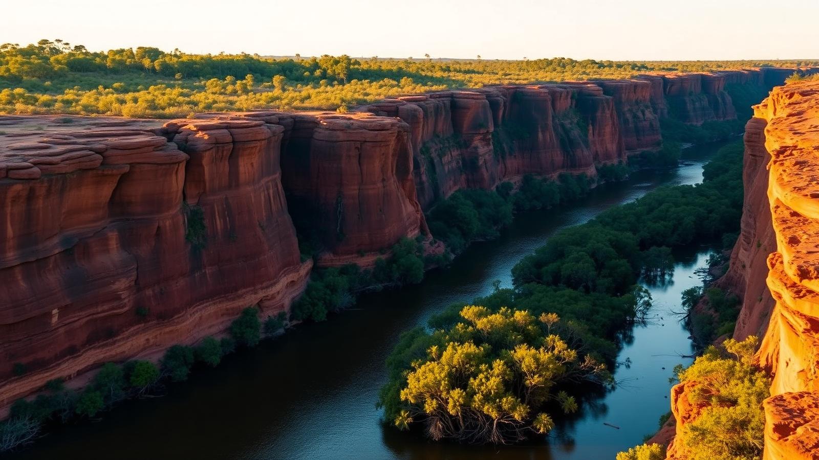
Hundreds of rocky islands off the western Kimberley coast, where an extreme tidal range forces water through narrow gaps. It is the tidal geography, rather than any settlement, that defines this area.
Expedition region
The Kimberley coast in north-west Australia is expedition cruising without ice: a tropical, almost roadless coastline where the defining force is one of the largest tidal ranges on earth, and where much of what there is to see sits on Aboriginal land.
Voyages run one way between Broome and Darwin, usually over ten days to two weeks, along a coast with almost no road access and very few settlements. Everything happens from the ship and its tenders, which is what makes it expedition cruising rather than coastal cruising.
The tide is the organising fact. Ranges of many metres drive water through gaps between islands, fill and empty long tidal rivers twice a day, and decide when a tender can reach a landing at all. A Kimberley day is planned around the tide table in a way no other region in this site requires.
Gateway
Broome and Darwin, with voyages usually running one way between them
2 gateways covered on this page.
Approach
The north-west coast of Australia, between Broome and the Northern Territory border
Operating areas
4 areas
Buccaneer Archipelago, central coast rivers, Hunter River, northern coast
Time ashore
Landings and cruising by small boat
Where and when depends on ice, weather and permission.
The second organising fact is land tenure. Large parts of the coast are Aboriginal-owned or jointly managed with Traditional Owners, and the rock art the region is known for is on country where access depends on agreement. Marine parks along the coast are managed by the Western Australian conservation authority together with Traditional Owners.
A plan, not a schedule
Conditions decide what happens each day, so the published route describes intent rather than a fixed sequence of stops.
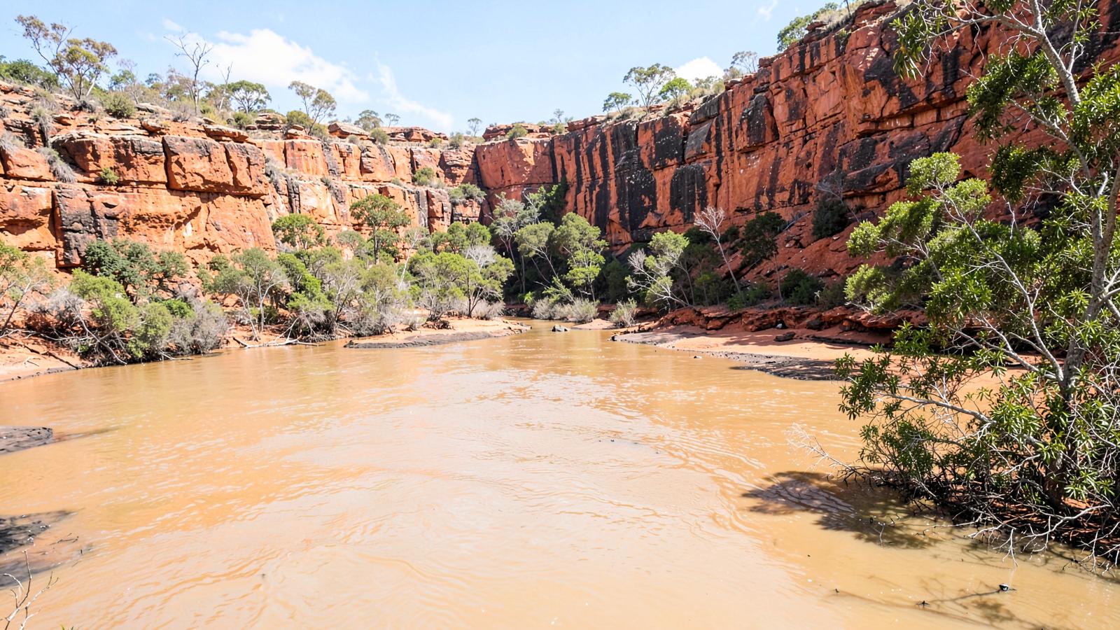
The Kimberley has one of the largest tidal ranges of any coast in the world. Water moves through gaps between islands, and long tidal rivers fill and empty twice a day. Many of the features a voyage exists to reach are only approachable near a particular state of the tide — some because there is not enough water at other times, some because the current through a narrow gap is too strong.
The result is a timetable built around a tide table. A landing may be scheduled before dawn or in the middle of the afternoon on consecutive days simply because that is when the water allows it, and two departures a fortnight apart can experience the same coast quite differently. This is the clearest example on the site of geography, rather than an operator's preference, dictating the structure of a day.
There are no ports along this coast and almost no road access to it. The ship anchors and the day happens in small boats: up tidal rivers, along cliff lines, onto beaches, and short walks inland from where a tender can reach. The vessel is essentially a mobile base, which is why ships here are small and shallow-draft rather than ice-strengthened.
That also sets the limits. Tender range and sea state decide how far from the anchorage a day can reach, and a feature that is a few kilometres inland is effectively out of reach unless a river leads to it.
| Kimberley | Antarctica and the Arctic | |
|---|---|---|
| Limiting force | Tide, and the monsoon season | Sea ice and daylight |
| Vessel requirement | Shallow draft and capable tenders | Ice-strengthened hull certified for polar waters |
| Voyage shape | One-way along a coast, between two gateway towns | Round trip or transit, with a crossing to the working area |
| Access to land | Depends on agreement with Traditional Owners and on operator licences | Depends on treaty or national regulation and site coordination |
| Closed period | The wet season, when voyages do not run | The winter, when the region is not reachable |
Much of the coast is Aboriginal land
Rock art and other cultural sites sit on country where visits depend on permission from Traditional Owners, so what a voyage may visit is a matter of agreement rather than of reaching the place.
Gateways and the broad areas voyages work in. The areas are approximate zones rather than routes or boundaries, and each one is described underneath the map.
Areas are drawn as soft zones because expedition geography has no fixed edges. They are not boundaries, not routes and not landing sites.
Expedition regions have very few places a voyage can begin. These are them.
| Gateway | Country or territory | Role | Why it matters |
|---|---|---|---|
| Broome | Australia | Main start or end point | Western end point for Kimberley coast voyages, on the edge of the Buccaneer Archipelago approaches. |
| Darwin | Australia | Main start or end point | Eastern end point in the Northern Territory. Most Kimberley voyages run one way between here and Broome rather than round trip. |
The areas a voyage is built around. Which specific places a ship visits inside an area is decided by the operator, the regulator and the conditions on the day.
Hundreds of rocky islands off the western Kimberley coast, where an extreme tidal range forces water through narrow gaps. It is the tidal geography, rather than any settlement, that defines this area.
Long tidal rivers cut into sandstone, including the Prince Regent River, within the marine and terrestrial parks jointly managed by the Western Australian conservation authority and Traditional Owners.
Access: Within managed marine park zones; commercial visits operate under licences and management plans issued by the state authority.
Mangrove-lined tidal river systems below the Mitchell Plateau, the usual point at which voyages move inland from the ship by tender or, where permitted, by helicopter.
The remote northern run towards the Northern Territory, with rock-art country on Aboriginal-owned land where access depends on agreement with Traditional Owners.
Access: Access to land here is a cultural permission question, not only a permit question.
The Kimberley has a monsoonal climate with a wet season from around November to March, bringing heavy rain, heat, humidity and cyclone risk. Cruising operates in the dry months in between, when conditions are settled.
Within the dry season, waterfalls fed by the previous wet season run strongest early and diminish as the months pass. That is a change in what the coast looks like, not in whether it is accessible.
| Month | Cruise activity |
|---|---|
| Jan | Essentially no cruises |
| Feb | Essentially no cruises |
| Mar | Essentially no cruises |
| Apr | Shoulder period |
| May | Peak cruise activity |
| Jun | Peak cruise activity |
| Jul | Peak cruise activity |
| Aug | Peak cruise activity |
| Sep | Shoulder period |
| Oct | Essentially no cruises |
| Nov | Essentially no cruises |
| Dec | Essentially no cruises |
Dry-season operating pattern. The wet season is not a quieter season here; voyages do not run.
Small ships chosen for shallow water and tender operations rather than for ice or ocean crossings.
Tidal rivers and reef-strewn approaches favour vessels that can work close inshore.
The number and capability of a ship's tenders affects how much of the coast a voyage can reach.
Some vessels carry a helicopter for inland access. Where it may land is controlled by park management and land tenure, not by the operator alone.
Tender cruising in tidal rivers, short walks ashore, and visits to cultural sites where access is agreed.
Long stretches of the day are spent in tenders inside river systems, without landing at all.
Landings tend to be short walks over rock to a waterfall, a lookout or an art site, in heat and often at low tide.
Saltwater crocodiles are present throughout these waters, which is why swimming and access to the water's edge are controlled by the crew.
The Kimberley has some of the largest tides in the world. The tide fills and empties whole river systems and creates fast-flowing passages between islands.
A sharply divided wet and dry season, with cruising confined to the dry months and heat significant even then.
There are almost no roads, settlements or services along the coast, so the ship is self-contained for the whole voyage.
Navigation is complicated by reefs, rocks and shifting sandbars, which is another reason vessels are small.
Who governs the area and what that means in practice. The regulator's own material is the authority on the detail.
Marine and terrestrial parks along the coast are managed by the Western Australian conservation authority under management plans that set what commercial visitors may do and where.
Several Kimberley parks are jointly managed with the Aboriginal groups whose country they cover, so management decisions are shared.
Tour operators working in the parks hold licences issued by the state authority, which is what permits organised visits at all.
Rock art and other cultural sites are on Aboriginal land or country. Visiting them depends on the agreement of Traditional Owners, and some places are not open to visitors.
Everything that constrains a polar voyage — ice class, ice edge, cold — is absent. The constraints here are tide, heat and land access instead.
Landings and river approaches are scheduled around the state of the tide, which is why two voyages the same month can see the same place very differently.
In the polar regions access is negotiated with the environment and a regulator. Here it is also negotiated with the people whose country the coast is.
The Antarctic Peninsula and the South Atlantic islands, reached from Ushuaia and Punta Arenas in the austral summer.
Svalbard, Greenland and the Northwest Passage — three Arctic cruising grounds with different jurisdictions and different seasons.
An Ecuadorian volcanic archipelago on the equator, cruised on fixed itineraries approved by the national park.
No ports, small ships, landings by small boat, and a regulator that decides what is possible.
Facts on this page are taken from the sources below. Cruise lines are used only as sources for facts about their own operations, never as sources of independent assessment.