Skip to content
SnapVoyagesIndependent cruise information
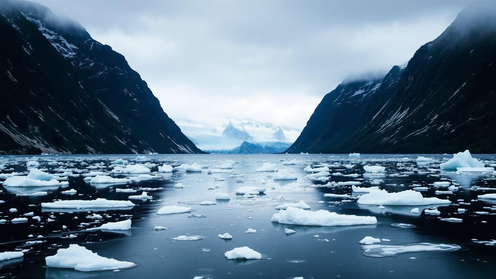
Illustrative AI-generated scene of an Arctic fjord with drifting ice and steep dark mountains under low summer light

Expedition region

Arctic expedition cruises

The Arctic is not one cruising ground but several, in different countries, with different seasons and different rules. Svalbard, Greenland and the Northwest Passage are the three that most clearly need to be understood separately.

The short answer

Unlike Antarctica, the Arctic has residents, sovereign states and settlements. That changes the whole shape of a voyage: you are travelling through inhabited territory, community visits are a normal part of an itinerary, and the rules come from national governments rather than from a treaty.

The three areas work quite differently. Svalbard is a compact Norwegian archipelago sailed as a round trip from a single town, and it is governed by some of the strictest environmental regulation applied anywhere to passenger shipping. Greenland is a long coastline with two very different sides: an inhabited west with icebergs and settlements, and a nearly empty east dominated by one enormous fjord system. The Northwest Passage is not a cruising ground at all but a transit, sailed in one direction through the Canadian Arctic in a window of a few weeks.
At a glance

Where it is
Svalbard, Greenland and the Canadian Arctic, north of roughly 66° north
Season
Boreal summer; broadly late May to September, shorter in the Northwest Passage
Gateways
Longyearbyen, Kangerlussuaq and Nuuk, Reykjavík, and Nome for transits
Main expedition areas
Svalbard, west Greenland and Disko Bay, east Greenland fjords, Northwest Passage
Vessel character
Ice-strengthened expedition ships, typically small enough to enter protected areas
Who governs it
National governments — Norway, Greenland and Canada — with AECO alongside

How a voyage here is assembled

  1. Gateway

    Longyearbyen, Kangerlussuaq and Nuuk, Reykjavík, and Nome for transits

    5 gateways covered on this page.

  2. Approach

    Svalbard, Greenland and the Canadian Arctic, north of roughly 66° north

  3. Operating areas

    4 areas

    Svalbard, west Greenland and Disko Bay, east Greenland fjords, Northwest Passage

  4. Time ashore

    Landings and cruising by small boat

    Where and when depends on ice, weather and permission.

AECO, the association of Arctic expedition cruise operators, plays a role loosely comparable to IAATO's in Antarctica, but it sits alongside national law rather than in place of it. In the Arctic the governing authority is always a state.

How expedition cruising works in the Arctic

Svalbard is a round trip
Voyages start and finish in Longyearbyen, circle or partly circle the archipelago, and are shaped by how far north the ice allows the ship to go that week.
Greenland is a coastal run
West coast voyages combine glacier fronts and Greenlandic towns; east coast voyages are almost entirely uninhabited fjord landscape. The two coasts are not interchangeable.
The Northwest Passage is a one-way transit
A crossing between the Atlantic and Pacific through the Canadian Arctic Archipelago, with flights at one or both ends. Very few voyages run in a season.
People live here
Arctic itineraries call at inhabited settlements. Community visits are agreed arrangements with local people, not sightseeing stops at an empty site.
What the itinerary is

A plan, not a schedule

Conditions decide what happens each day, so the published route describes intent rather than a fixed sequence of stops.

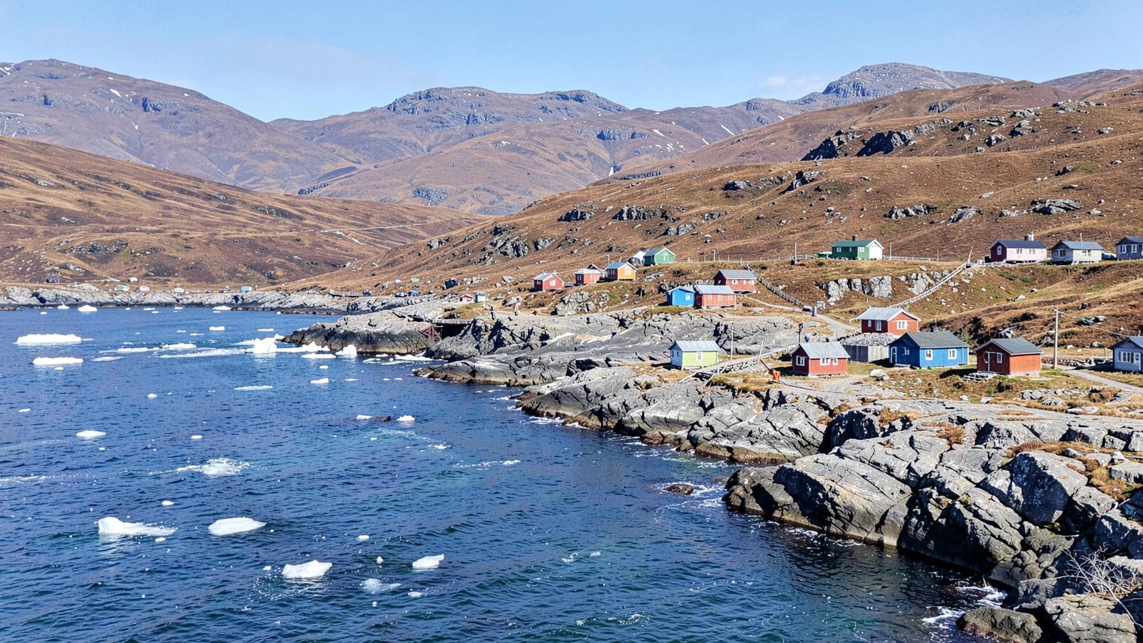
A small Arctic settlement of colourful wooden houses on bare rock beside a fjord with drifting ice
People live in the Arctic. Settlements on the coast are part of the route, which makes a visit an arrangement with a community rather than a stop at an empty site.

Why the Arctic is not one cruising ground

Antarctica has one governing framework and one working season. The Arctic has none of that. Svalbard, Greenland and the Canadian Arctic are separate jurisdictions with separate rules, separate ice behaviour and separate seasons, and a voyage in one tells you very little about a voyage in another. The single word 'Arctic' in an itinerary title is the least informative part of it.

The other structural difference is that people live here. Arctic routes pass inhabited settlements, and a call at a community is an arrangement with that community rather than a stop at an empty site. That changes what a day ashore can consist of, and it introduces a constraint Antarctica does not have: the visit has to work for the people living there.

Three Arctic grounds, three different voyage structures
 SvalbardGreenlandNorthwest Passage
Voyage shapeRound trip from one townCoastal run along one side of a very long coastOne-way transit between two oceans
AccessFly to Longyearbyen, board thereFly to a coastal gateway; the two coasts are reached differentlyFlights at both ends of the transit
Limiting factorHow far north the ice allows that weekIce and weather along an exposed coastWhether the route clears at the late-summer ice minimum
SeasonBroadly late spring to SeptemberBroadly summer into SeptemberA narrow window in late summer
Who governs itNorway, with strict environmental regulationGreenland and DenmarkCanada

Why Greenland's two coasts are not interchangeable

West Greenland is the inhabited side: towns, airports, a working coast and glacier fronts that calve into bays used for everyday travel. A voyage there combines landscape with places where people live, and access is comparatively straightforward because the infrastructure exists.

East Greenland is nearly empty and dominated by an enormous fjord system. There is far less settlement, far less infrastructure and more exposure to drifting ice on the approach. The two coasts produce different voyages from the same country, and an itinerary that says only 'Greenland' has not yet told the reader which one it means.

Why the transit window is so narrow

The route only opens at the ice minimum

The Northwest Passage is navigable for a short period in late summer, and a season's ice conditions can still force a reroute or a shortened transit.

The expedition geography

Gateways and the broad areas voyages work in. The areas are approximate zones rather than routes or boundaries, and each one is described underneath the map.

SvalbardWest Greenland and Disko BayEast Greenland fjordsNorthwest PassageLongyearbyenKangerlussuaqNuukReykjavíkNome

Everything on this map, as text

Gateways

  • Longyearbyen (Norway (Svalbard)) — The main settlement on Svalbard and the turnaround point for most Svalbard voyages, reached by air from mainland Norway.
  • Kangerlussuaq (Greenland) — Long-runway airport at the head of a west Greenland fjord, used to fly passengers in and out for voyages along the west coast.
  • Nuuk (Greenland) — Greenland's capital, used as a turnaround or call on west coast voyages.
  • Reykjavík (Iceland) — Common start or end point for voyages that reach Greenland or begin a Northwest Passage transit by sea rather than by air.
  • Nome (United States (Alaska)) — Western end point used by Northwest Passage transits, on the Alaskan side of the Bering Strait.

Expedition areas

  • Svalbard A Norwegian high-Arctic archipelago at around 78° north, with deep west-coast fjords, glacier fronts and, in most summers, reachable pack ice to the north. Large parts of the archipelago are protected areas under Norwegian law.
  • West Greenland and Disko Bay The inhabited west coast, including Disko Bay and the Ilulissat Icefjord, a UNESCO World Heritage site fed by one of the most productive glaciers outside Antarctica. Voyages here combine ice and settlements, so this is the part of the Arctic where Greenlandic communities are a normal part of the itinerary.
  • East Greenland fjords A far less populated coast dominated by the Scoresby Sund fjord system, the largest in the world by area. Access depends on the East Greenland ice drifting south along the coast.
  • Northwest Passage The sea route through the Canadian Arctic Archipelago between the Atlantic and the Pacific, taking in Lancaster Sound — protected as Tallurutiup Imanga National Marine Conservation Area — and Inuit communities in Nunavut. It is a transit rather than a cruising ground: a ship passes through once and comes out the other side.

Areas are drawn as soft zones because expedition geography has no fixed edges. They are not boundaries, not routes and not landing sites.

Gateways

Expedition regions have very few places a voyage can begin. These are them.

Gateways used by Arctic expedition voyages
GatewayCountry or territoryRoleWhy it matters
LongyearbyenNorway (Svalbard)Main start or end pointThe main settlement on Svalbard and the turnaround point for most Svalbard voyages, reached by air from mainland Norway.
KangerlussuaqGreenlandMain start or end pointLong-runway airport at the head of a west Greenland fjord, used to fly passengers in and out for voyages along the west coast.
NuukGreenlandOccasional or secondaryGreenland's capital, used as a turnaround or call on west coast voyages.
ReykjavíkIcelandOccasional or secondaryCommon start or end point for voyages that reach Greenland or begin a Northwest Passage transit by sea rather than by air.
NomeUnited States (Alaska)Occasional or secondaryWestern end point used by Northwest Passage transits, on the Alaskan side of the Bering Strait.

Main expedition areas

The areas a voyage is built around. Which specific places a ship visits inside an area is decided by the operator, the regulator and the conditions on the day.

Svalbard

A Norwegian high-Arctic archipelago at around 78° north, with deep west-coast fjords, glacier fronts and, in most summers, reachable pack ice to the north. Large parts of the archipelago are protected areas under Norwegian law.

Access: Round trips from Longyearbyen. Where a ship may go, and what may happen ashore, is set by Norwegian environmental regulation rather than by the operator.

West Greenland and Disko Bay

The inhabited west coast, including Disko Bay and the Ilulissat Icefjord, a UNESCO World Heritage site fed by one of the most productive glaciers outside Antarctica. Voyages here combine ice and settlements, so this is the part of the Arctic where Greenlandic communities are a normal part of the itinerary.

East Greenland fjords

A far less populated coast dominated by the Scoresby Sund fjord system, the largest in the world by area. Access depends on the East Greenland ice drifting south along the coast.

Access: Short reachable window; sea ice on this coast closes it earlier than the west.

Northwest Passage

The sea route through the Canadian Arctic Archipelago between the Atlantic and the Pacific, taking in Lancaster Sound — protected as Tallurutiup Imanga National Marine Conservation Area — and Inuit communities in Nunavut. It is a transit rather than a cruising ground: a ship passes through once and comes out the other side.

Access: A very short ice window, and the transit is the itinerary. Route changes and rerouting are ordinary here, not exceptional.

When voyages operate

Svalbard and Greenland are broadly reachable from late May or June to September. The limiting factor at each end of the season is sea ice, and in Svalbard the northern part of the archipelago opens later than the west coast.

The Northwest Passage has a far narrower window, generally August into early September, because the route only clears in the late summer minimum. That is also why a transit can be rerouted or cut short by ice in any given year.

Cruise activity through the year — Arctic
Essentially no cruisesShoulder periodPeak cruise activity
Read this as a table
Relative cruise activity by month in the Arctic cruise region
MonthCruise activity
JanEssentially no cruises
FebEssentially no cruises
MarEssentially no cruises
AprEssentially no cruises
MayShoulder period
JunPeak cruise activity
JulPeak cruise activity
AugPeak cruise activity
SepShoulder period
OctEssentially no cruises
NovEssentially no cruises
DecEssentially no cruises

Combined pattern across the three Arctic areas. The Northwest Passage window is narrower than this, roughly August to early September.

Ship and vessel character

Small ice-strengthened ships dominate, partly because of the ice and partly because passenger number decides where a ship may operate.

Polar Code certification

Ships operating in Arctic waters are certified under the IMO Polar Code, which sets requirements for the hull, equipment, crew and voyage planning.

Fuel rules

Heavy fuel oil is banned in Svalbard waters under Norwegian regulation, so ships sailing there run on lighter fuels.

Size affects access

Norwegian regulation limits where larger passenger ships may operate in Svalbard's protected areas, which is why the fleet there is mostly small.

Landings and cruising from the ship

A mix of small-boat landings in wild country, settlement visits, and cruising among ice from the ship.

Landings in wild areas

Made by inflatable boat at sites the operator selects within what regulation allows. In Svalbard, protected-area rules restrict where landings may happen at all.

Settlement visits

In Greenland and the Canadian Arctic, calls at towns and communities are part of the voyage and depend on local agreement.

Wildlife safety shapes operations

Polar bears are present across Svalbard, Greenland's coasts and the Canadian Arctic. Precautions against encounters are a standing part of how any landing is run.

Environmental conditions

Sea ice sets the limits

Where a ship can go is decided by the ice edge on the day. It varies through the season and between years.

Midnight sun

Above the Arctic Circle the sun does not set for part of the summer, so operations are not limited by daylight.

Icebergs and calving fronts

West Greenland's glaciers produce large icebergs that drift down the coast. Approaches to glacier fronts are kept at a distance for that reason.

Remoteness

Assistance can be far away, especially in the Canadian Arctic, which is one reason voyage planning requirements are strict.

Regulation, at orientation level

Who governs the area and what that means in practice. The regulator's own material is the authority on the detail.

Norway governs Svalbard

The Svalbard environmental legislation and the Governor of Svalbard set what is allowed: protected areas, landing restrictions, distances to wildlife and the heavy fuel oil ban.

Greenland sets its own visitor rules

Greenland is a self-governing part of the Kingdom of Denmark and administers access, permits and community tourism arrangements itself.

Canada governs the Northwest Passage

Transits are subject to Canadian Arctic shipping and pollution prevention requirements, and Lancaster Sound is a protected national marine conservation area co-managed with Inuit organisations.

AECO alongside national law

AECO publishes operational and site guidelines for Arctic expedition cruising, including community visit guidelines, which members apply in addition to national regulation.

What makes this expedition region different

Three areas, three sets of rules

Unlike Antarctica, there is no single Arctic regime. A Svalbard voyage and a Northwest Passage transit have almost nothing regulatory in common.

Inhabited territory

The Arctic has residents and their own governments. Community visits are a normal itinerary element, and the etiquette around them is formalised.

The Northwest Passage is a route, not a region

It is sailed once, in one direction, in a narrow window. Treating it as a cruising ground misrepresents what it is.

Key things to understand

Key facts

  • The Arctic is several jurisdictions, not one region: Norway, Greenland and Canada each govern their own waters.
  • Svalbard voyages are round trips from Longyearbyen, under strict Norwegian environmental regulation.
  • Heavy fuel oil is banned in Svalbard waters, and larger ships are restricted in protected areas.
  • West Greenland combines icebergs and inhabited towns; east Greenland is fjord landscape with almost no settlement.
  • The Northwest Passage is a one-way transit with a window of roughly August to early September.
  • AECO guidelines apply alongside national law, not instead of it.
  • Polar bears are present across the region, which shapes how landings are run.

What to check when comparing voyages

  • Which Arctic area the voyage actually covers — they are not interchangeable.
  • Whether the itinerary is a round trip or a one-way transit with flights at each end.
  • How far north the route intends to go, and what the operator says about ice changing it.
  • Whether community visits are included, and how the operator describes them.
  • The ship's ice class and passenger number, which affect where it may operate.
  • Whether the operator is an AECO member and which national authority applies to the route.

Sources & verification

Facts on this page are taken from the sources below. Cruise lines are used only as sources for facts about their own operations, never as sources of independent assessment.