Expedition
The Drake Passage and Antarctica cruises
Between the tip of South America and the Antarctic Peninsula lies the stretch of water every ship-based Antarctic Peninsula voyage from Ushuaia has to cross — or that a fly-cruise is built specifically to skip.
The short answer
The Drake Passage is the body of water between Cape Horn and the South Shetland Islands off the Antarctic Peninsula. It connects the Atlantic and Pacific and is the open-ocean crossing on most ship-based Antarctic Peninsula voyages from Ushuaia, taking roughly two days each way. A smaller number of "fly-cruise" or "air-cruise" itineraries instead fly passengers from Punta Arenas, Chile, to an airstrip on King George Island, joining or leaving the ship there in about two hours.
Neither option can guarantee sea conditions or a fixed schedule. Sailing trades two sea days (in each direction) that can be calm or rough for a fuller sense of arriving at the edge of the Southern Ocean; flying trades that time and uncertainty for a different, weather-dependent uncertainty of its own, at a higher price and on a shorter itinerary. Which suits a traveller better depends on time available, tolerance for motion, budget and how much the crossing itself matters to the trip.
By The SnapVoyages TeamPublished October 2026
Geography
Where the Drake Passage is, and why it matters
Points plotted from published coordinates; coastlines deliberately omitted. The dashed line marks the narrowest gap between South America and the South Shetland Islands, not a ship's track.
- North side
- Cape Horn, Chile (≈56° S)
- South side
- South Shetland Islands (≈62° S)
- Width
- About 1,000 km (≈600 mi) at its narrowest
- Connects
- Atlantic and Pacific; part of the Southern Ocean
The Drake Passage is not just a stretch of open water: it is the narrowest gap in the Southern Ocean, and the fact that nothing else interrupts the sea at these latitudes below Cape Horn is exactly what makes it both oceanographically distinctive and operationally significant for every Antarctic Peninsula voyage that departs from South America by ship. Almost all seaborne Antarctic Peninsula tourism — more than 95% of landed visitor activity according to IAATO's reporting to the Antarctic Treaty system — is carried on conventional expedition ships that make this crossing, rather than by yacht or fly-cruise.
The mechanism
Why the crossing can be rough
What makes this stretch different from other seas?
The Antarctic Circumpolar Current flows eastward all the way around Antarctica, and the Drake Passage is the narrowest point it has to squeeze through. It is the only ocean current that circles the globe without meeting a continent.
Strong westerly winds blow over the Southern Ocean at these latitudes for the same reason: there is very little land to slow them. Waves can build over long distances (fetch) before they reach the passage. When a low-pressure system crosses, the sea state can change within hours.
None of this produces a fixed 'average' crossing. It produces a sea that ranges widely, which is why honest descriptions avoid promising either extreme.
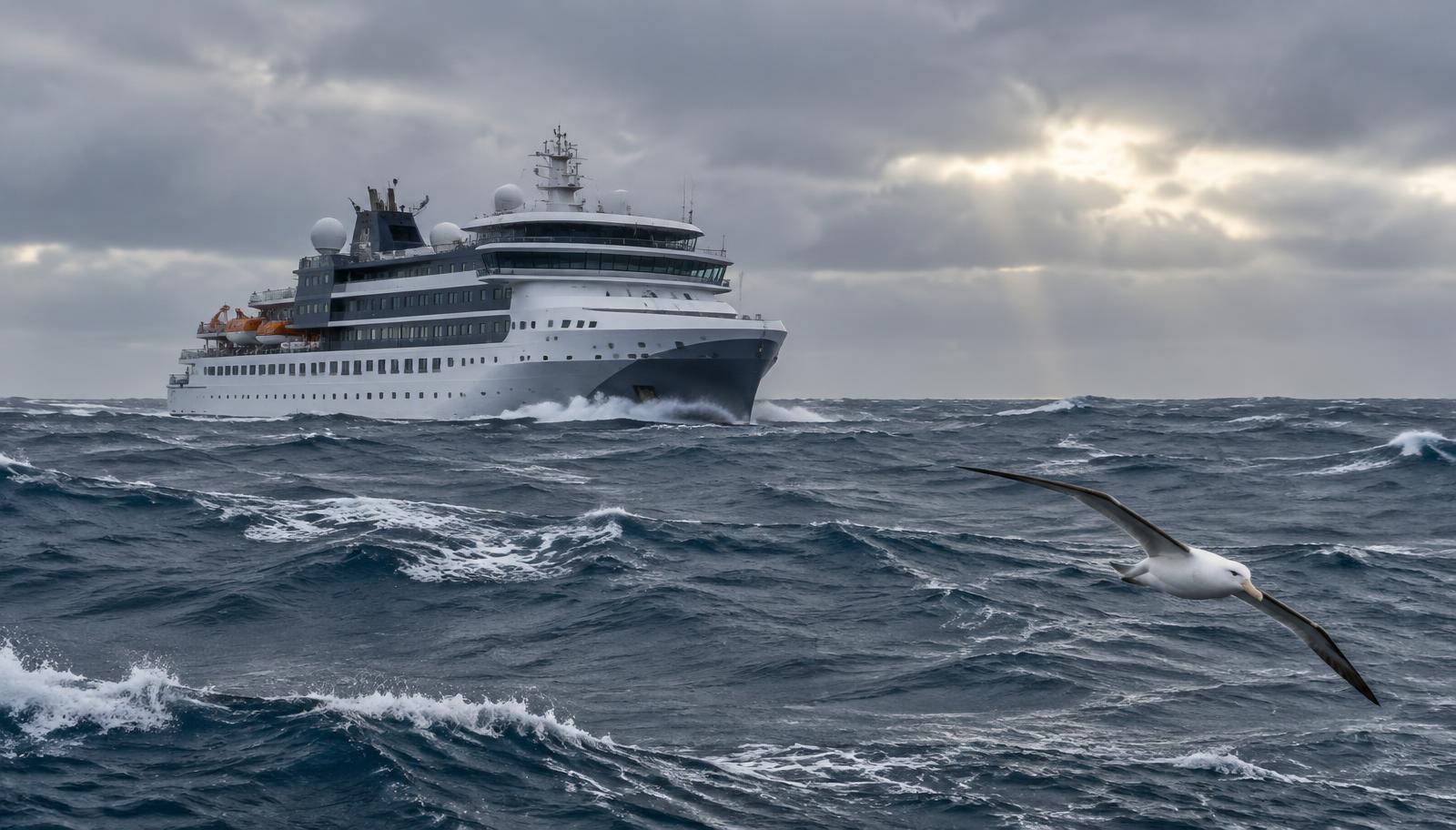
Informal vocabulary
Drake Shake and Drake Lake
Two phrases used by crews and passengers for the two ends of the range. They are slang, not forecasts.
| What it describes | What it means for passengers | |
|---|---|---|
| “Drake Lake” | A crossing with relatively calm sea and low swell | Decks and lectures open as normal; movement is noticeable but manageable for most |
| In between | Moderate swell and wind — a common description of many crossings | Walking needs a handrail; some people feel seasick |
| “Drake Shake” | Heavy swell and strong wind | Outer decks may be closed, people keep to cabins, the crossing can be slowed |
Which one a voyage meets depends on the weather systems crossing that week, not on the season, the ship or the operator. Modern expedition vessels built for polar routes carry stabilisers and hull forms designed for Southern Ocean conditions, and these change how motion is felt on board — they do not change the sea itself, and no vessel is immune to a genuinely severe system. Avoid trusting any claim that a particular ship "doesn't get the Drake Shake."
Practical implications
What the crossing means on a ship-based voyage
- Two days each way
- From Ushuaia the crossing is about two days in each direction, so on a typical 10–11 day voyage roughly a third to two-fifths of the trip is spent crossing, not in Antarctic waters.
- Schedules move
- Captains may slow down, change course or wait for weather. Arrival and departure times are planned, not guaranteed, and a late or slow crossing can shorten time at the Peninsula.
- Seasickness planning
- Prevention and medication are a medical question for your doctor; the practical point for planning is to expect the possibility rather than assume it away, on a crossing that can last roughly 48 hours in each direction.
- Sea days are used
- Expedition ships typically fill crossing days with mandatory IAATO biosecurity procedures (boot and gear decontamination), briefings and lectures from the expedition team, so the time is structured rather than empty.
- Biosecurity is mandatory, not optional
- IAATO member operators require passengers to clean and inspect boots, outerwear and equipment before the first landing, to avoid introducing seeds, soil or pathogens to the Antarctic environment.
Expect either, plan for both
Neither a month nor a ship size guarantees a calm crossing, and a rough outbound crossing says nothing about the return.
An alternative
Flying instead: fly-cruise to King George Island
Several operators sell "fly-cruise" or "air-cruise" itineraries that replace one or both sea crossings with a charter flight between Punta Arenas, Chile, and an airstrip on King George Island in the South Shetland Islands, where passengers join or leave the expedition ship by Zodiac. The flight itself takes roughly two hours, against about two days by sea, and several operators market the main draw as avoiding Drake Passage motion and seasickness entirely on the legs that are flown.
King George Island carries the only usable airstrip in this part of Antarctica, on the ice-free Fildes Peninsula at its south-western corner, and it sits at the edge of several national research stations. Because it is a single airstrip at the edge of the continent, with no large paved alternative nearby, flight operations there are entirely dependent on local weather at both ends of the route — Punta Arenas and the island itself — and conditions can prevent a flight from departing on either side even when the forecast further along the route looks fine.
What happens when the flight can't go?
Operators that run this itinerary publish contingency plans precisely because delays are a known, recurring feature of the route rather than a rare exception. The common pattern: guests gather in Punta Arenas and remain on standby, sometimes for several days, while the operator watches for a weather window at the airstrip; the operator provides hotel accommodation and meals during the wait.
If the flight still cannot operate after a defined number of days, operators typically cancel that voyage (or route disembarking guests overland to an alternative port such as Puerto Williams for a return flight) and point guests toward their travel insurance for delay and cancellation costs. None of this is a fault in the plan — it reflects a genuinely difficult flying environment at the edge of the Southern Ocean.
The choice
Sailing versus flying: a substantial comparison
| Ship-based crossing (sail both ways) | Fly-cruise (fly one or both ways) | |
|---|---|---|
| Time to reach the Peninsula | About two days each way by ship from Ushuaia — four days of the trip spent crossing. | About two hours each way by charter flight from Punta Arenas when weather allows — far more time available for the Peninsula itself on a similar total trip length. |
| What can disrupt the plan | Sea state and weather can slow the ship or change the route within the open ocean; the crossing itself is rarely cancelled outright. | The flight depends on acceptable weather at both the Punta Arenas and King George Island ends; flights can be delayed by days, and some itineraries are cancelled outright if no weather window opens. |
| Physical experience | Two full sea days of varying motion, from calm to rough; seasickness is a realistic possibility in both directions. | A short flight avoids most open-ocean motion on the legs flown, though turbulence and typical short-haul discomfort still apply. |
| Typical itinerary length and cost | Often a longer voyage (around 10–11 days or more) that includes the crossing as part of the experience. | Often a shorter, more compact itinerary focused on time at the Peninsula; fly-cruise programs are generally positioned and priced as a premium or specialist option by the operators that run them. |
| Who it suits | Travellers who want the complete Southern Ocean crossing as part of the story, have more time, or prefer not to depend on a single airstrip's weather window. | Travellers short on time, prone to seasickness, or who specifically want to minimise open-ocean days — while accepting a different, flight-weather-driven uncertainty and a different budget. |
Sailing suits you if
The crossing itself is part of the trip
- You have the extra days and want the full Southern Ocean experience, calm or not.
- You would rather not depend on a single remote airstrip's weather for your whole itinerary.
- Budget matters more than compressing the schedule.
- You are reasonably comfortable with, or prepared for, open-ocean motion over two days.
Flying suits you if
Time and motion are the priority
- You have limited vacation time and want to maximise days actually at the Peninsula.
- You are particularly prone to seasickness or have a medical reason to avoid prolonged ship motion.
- You can tolerate the possibility of a multi-day weather delay in Punta Arenas, with trip insurance in place.
- The fly-cruise's typically higher price and shorter, more specialist itinerary fit your plans.
Reader questions
The follow-up questions
- Is the Drake Passage dangerous?
- Modern expedition ships are built and operated for Southern Ocean conditions, and operators plan voyages around weather forecasts. This guide does not make medical or safety claims about any individual crossing; sea conditions still range from calm to genuinely rough, and travellers prone to seasickness should plan accordingly and speak with a doctor in advance.
- Can I choose to fly one way and sail the other?
- Several operators offer exactly this combination — flying one direction and sailing the other — as a way to experience the crossing once while shortening the total trip. Availability depends on the specific operator and season.
- Does flying guarantee I will avoid seasickness entirely?
- Flying removes most of the open-ocean motion on the legs that are flown, but it does not remove ordinary flight turbulence or the ship's own movement once you are aboard in Antarctic waters, where seas can still build.
- What if the King George Island flight is delayed for several days?
- Fly-cruise operators publish contingency plans for exactly this scenario; the common pattern is hotel accommodation and standby in Punta Arenas, with cancellation and insurance guidance if no weather window opens within the time built into the itinerary. Terms differ by operator and should be checked before booking.
- How does the crossing fit into the wider Antarctic trip?
- The crossing is the gateway, not the destination: landings, wildlife, permits and the operating season for the Peninsula itself are covered on the Antarctica expedition page.
Sources & verification
Geography (Cape Horn to the South Shetland Islands, about 1,000 km wide) from Britannica; oceanography from government and research bodies; the proportion of seaborne versus other Antarctic tourism and biosecurity practice from IAATO's reporting to the Antarctic Treaty system; King George Island's airstrip and terrain from the British Antarctic Survey's forecasting handbook; fly-cruise timings, routes and contingency practices from operators that run them (Antarctica21, Aurora Expeditions, Quark Expeditions), read as evidence of their own operations rather than independent assessment. No sea-state statistics, wave-height probabilities or guaranteed crossing times are given because none are published for passenger planning.
- Encyclopaedia Britannica — Drake Passage — read 2026-10-10
- British Antarctic Survey — Southern Ocean and the Antarctic Circumpolar Current — read 2026-10-10
- NOAA Ocean Service — ocean currents and the Antarctic Circumpolar Current — read 2026-10-10
- IAATO — International Association of Antarctica Tour Operators — read 2026-09-01
- IAATO — Antarctic Vessel Overview of Antarctic Tourism (ATCM information paper, 2023-24 season) — read 2026-10-10
- British Antarctic Survey — International Antarctic Weather Forecasting Handbook, King George Island — read 2026-10-10
- Antarctica21 — Essential Guide: Flying to Antarctica (Punta Arenas–King George Island) — read 2026-10-10
- Antarctica21 — Antarctic Air-Cruises overview — read 2026-10-10
- Aurora Expeditions — Contingency plans for fly/sail and fly/fly voyages (King George Island charter flights) — read 2026-10-10
- Quark Expeditions — Antarctic Express: Fly the Drake brochure (contingency plan) — read 2026-10-10